
ESA Backs Treeconomy’s Forest Carbon Platform: How Satellites Are Entering Climate Finance
- October 19, 2026
- Posted by: admin
- Category: Uncategorized
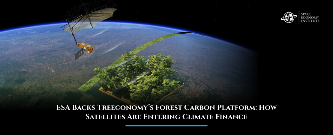
A forest may not look like part of the space economy. But increasingly, its economic value can be measured from orbit.
UK-based Treeconomy has announced a new contract with the European Space Agency (ESA) to scale its forest biomass monitoring technology. The project, called GAIA-M, will combine satellite observations, field measurements and eventually drone LiDAR to assess entire forest portfolios rather than individual projects.
The development illustrates an important shift in the space economy: satellites are no longer valuable only because of the hardware orbiting Earth. Increasingly, the business opportunity lies in turning space-generated data into information that companies, investors and governments can use on the ground.
What Can a Satellite Tell Us About a Forest?
One of the most important measurements is biomass: the amount of organic material contained in vegetation, particularly trees.
Why does that matter financially?
Trees absorb carbon dioxide as they grow and store carbon in trunks, branches and roots. Estimating how much biomass exists in a forest therefore helps estimate how much carbon that forest contains—and how those stocks change over time.
Traditionally, this requires people to visit forests, measure trees and extrapolate the results across larger areas. Those surveys remain important, but they can be expensive, slow and difficult in remote regions.
Earth-observation satellites change the scale of the problem.
Optical imagery can monitor changes in vegetation and land use. Radar can gather information even through clouds, while more advanced sensors can provide insight into forest structure. ESA’s Biomass satellite, whose data became openly available in 2026, uses P-band radar capable of penetrating dense forest canopies and measuring woody material such as trunks and large branches.
The result is not simply a photograph of a forest. It is data that can help estimate what is physically there and how it is changing.
From Satellite Images to Financial Information
This is where the business model becomes more interesting.
A satellite image on its own has limited value to an investment manager deciding whether to finance a reforestation project. What that investor actually needs is an answer to questions such as:
How much carbon is stored here? Is the forest growing as expected? Has part of it been cut down? How certain are those estimates?
Companies increasingly build software and analytics layers that translate raw Earth-observation data into those answers.
Treeconomy says its GAIA-M system will combine satellite information with measurements collected directly at project sites and explicitly report the uncertainty around its estimates. The company intends to expand the model over the next 12 months with additional satellite data, including ESA Biomass observations, and drone-based LiDAR.
That process is commonly described as Monitoring, Reporting and Verification, or MRV.
MRV matters because environmental assets only become financially useful if investors and buyers can trust what they represent.
Consider a company purchasing forest carbon credits. In simplified terms, each credit represents a quantified amount of carbon dioxide removed from or prevented from entering the atmosphere. If the underlying forest cannot be measured reliably, the economic credibility of the credit is weakened.
Satellite data can help make that verification more continuous, scalable and independent.
Why Space Matters to the Carbon Market
This is a good example of the downstream space economy.
The upstream space industry builds satellites and launch vehicles. Downstream companies use the information produced by those systems to solve problems in industries such as agriculture, insurance, energy, logistics or finance.
In forest carbon markets, one of the biggest challenges is the cost and reliability of monitoring large territories.
ESA itself highlights problems such as inconsistent carbon estimation, expensive verification and limited traceability as barriers to credible forest-carbon projects. Its supported applications increasingly combine satellite imagery and artificial intelligence to estimate tree height, canopy cover and above-ground biomass across large areas.
The economic value therefore comes from reducing uncertainty.
If an investor can monitor thousands of hectares more efficiently, due diligence can become faster. If a carbon-credit buyer can verify that a forest remains intact, the risk associated with the asset falls. If regulators can detect deforestation or land-use change independently, environmental claims become easier to audit.
Satellites effectively become part of the information infrastructure behind financial decisions.
A Bigger Market Than Satellite Images
The broader opportunity extends well beyond carbon credits.
The same Earth-observation infrastructure can support insurance companies assessing wildfire or flood exposure, banks evaluating physical climate risks, governments monitoring deforestation, agricultural companies tracking crops and businesses demonstrating compliance with environmental regulation.
This is why the commercial value of Earth observation increasingly depends not just on producing more imagery, but on converting imagery into actionable intelligence.
Open satellite datasets such as Europe’s Copernicus programme can also enable private companies to build services without owning satellites themselves. Their competitive advantage can instead come from software, artificial intelligence, domain expertise and the ability to integrate multiple data sources.
When Space Data Becomes Economic Infrastructure
Treeconomy’s new ESA-backed project is relatively small compared with a new rocket or satellite constellation, but it illustrates one of the most important dynamics in the modern space economy.
Some of the sector’s largest future opportunities may emerge when customers stop thinking about “space” altogether.
A fund manager evaluating a forest, an insurer pricing climate risk or a company verifying its supply chain may simply purchase better information. Satellites happen to be the infrastructure making that information possible.
If this intersection between Earth observation, finance, technology and new business models interests you, the Master in Space Economy by the Space Economy Institute explores how space capabilities create economic value across industries far beyond the traditional aerospace sector. Discover more about the Master and how space-based technologies are becoming embedded in the wider global economy.