AI-Powered Earth Observation: The Next Big Market in the Space Economy
- June 23, 2026
- Posted by: admin
- Category: Artificial Intelligence
The New Intelligence Layer Above Earth
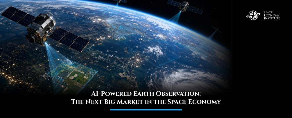
Earth observation is moving from satellite imagery to actionable intelligence. The shift is no longer about simply taking pictures of the planet; it is about using artificial intelligence to detect patterns, predict risks, and support decisions in near real time. On June 22, 2026, Safran Electronics & Defense and India’s SatSure announced a partnership to develop geospatial intelligence solutions, highlighting one of the hottest trends in the space economy today.
From Satellite Images to Decision Systems
For years, Earth observation was mainly associated with maps, weather monitoring, and scientific research. Today, it is becoming a strategic intelligence layer for governments, companies, insurers, banks, farmers, and infrastructure operators.
The reason is simple: the planet is producing more data than humans can manually interpret. Optical satellites, radar satellites, drones, weather sensors, and ground data streams are generating massive volumes of information. Artificial intelligence makes this data usable by identifying crop stress, infrastructure damage, illegal activity, flood exposure, military movement, supply-chain disruption, and climate risks.
This changes the business model. Instead of selling raw satellite images, companies can sell answers: Which fields are at risk? Which ports are congested? Which roads are damaged after a flood? Which assets are exposed to wildfire? Which regions are expanding urban infrastructure too quickly?
That is why AI-powered Earth observation is becoming one of the most commercially attractive sectors in the space economy.
The Safran–SatSure Signal
Safran and SatSure announced their GEOINT partnership on June 22, 2026, as part of the France–India Year of Innovation. Reuters reported that SatSure recently received a 246 million rupee grant to build AI-powered Earth observation models using satellite and drone data, linked to India’s push for sovereign AI and space capabilities.
The Safran–SatSure partnership is especially relevant because it combines aerospace-grade sensing, defense expertise, and AI-driven geospatial analytics. Safran brings advanced aerospace and defense capabilities, while SatSure brings Earth intelligence solutions tailored to India’s geography, economy, and public-sector needs.
India is an important market for this shift. It has vast agricultural regions, fast-growing cities, complex infrastructure networks, monsoon-driven climate dynamics, and increasing national security requirements. In such an environment, geospatial intelligence is not a luxury. It becomes a tool for resilience, planning, and sovereignty.
SatSure also recently received funding from India’s space regulator to build AI-powered Earth observation models using satellite and drone data. This points to a wider policy trend: governments want domestic AI and satellite intelligence systems rather than full dependence on foreign data providers.
Why the Market Is Growing
Estimated to grow from about $5.1 billion in 2026 to $11.4 billion by 2035, the commercial Earth observation market is expanding because demand is becoming cross-sector. Defense agencies want persistent monitoring. Agriculture needs crop intelligence. Insurance companies need better risk models. Banks want asset-level visibility. Energy firms monitor pipelines, grids, and natural resources. Governments need faster disaster response.
This is where AI creates value. A satellite image may show a flooded area. An AI-powered geospatial system can estimate which roads are unusable, which crops are damaged, which villages are exposed, and where emergency resources should go first.
The next competitive advantage will come from combining multiple data types: optical imagery, synthetic aperture radar, hyperspectral data, weather data, drone imagery, financial records, and local ground truth. The companies that can turn these layers into reliable decision products will own the most valuable part of the Earth observation value chain.
The Rise of Edge Intelligence in Orbit
Another emerging trend is onboard processing. Traditionally, satellites captured data, sent it to ground stations, and waited for processing on Earth. But as satellite constellations grow, downlink capacity can become a bottleneck.
New systems are beginning to process data closer to where it is collected, sometimes directly onboard satellites. This can reduce latency and allow faster alerts for time-sensitive use cases such as maritime surveillance, wildfire detection, disaster response, and defense monitoring.
In the future, Earth observation satellites may behave less like cameras and more like intelligent orbital sensors, deciding what to observe, what to process, and what to transmit first.
Conclusion
AI-powered Earth observation is turning satellite data into a high-value intelligence market. The Safran–SatSure partnership shows how defense, climate, agriculture, infrastructure, and digital sovereignty are converging around geospatial intelligence. This is one of the clearest examples of how the space economy is becoming useful on Earth.
If this topic is of interest, you can learn more about Earth observation markets, satellite data analytics, and geospatial intelligence in the Master in Space Economy by the Space Economy Institute. Discover more about the Master and explore how satellite data is shaping the future of global decision-making.